|
District NRDMS Center,
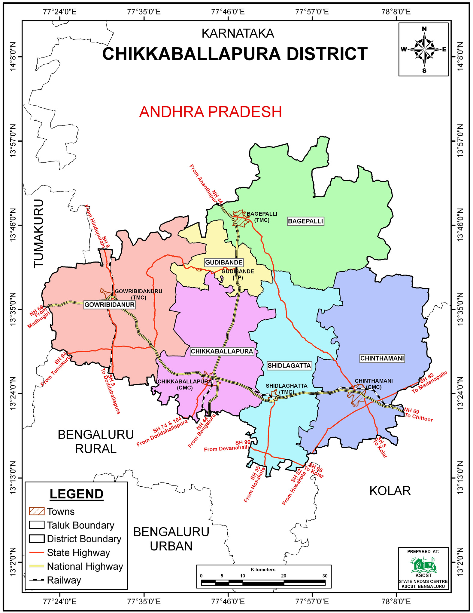
Chikkaballapura
O/o Zilla Panchayath, Chikkaballapura District - 562101
Introduction
The
Chikkaballapura
district NRDMS
Centre was established in the year
2008-2009
at Office of the
Chikkaballapura
Zilla Panchayath
with financial support from Department of Science and
Technology, Government
of India, Implemented by K.S.C.S.T, Bangalore with active
support from Department
of Science &
Technology, Government
of Karnataka. The main objective of the centre is to create
the digital database on Natural resources, Demography, Agro &
Socio economy and infrastructure facilities of the
District to provide analysed information to the district
administrators, Zilla panchayath, line departments, Academic
institutions and NGOs in Natural resources management and
rural development planning with the help of GIS and
other advanced scientific technologies.

Activities carried
out at District NRDMS Centre
-
The primary
objective of District NRDMS Centre under NRDMS Project is to
create Extensive database on Spatial Database (Maps) and Non-Spatial
Database (Attribute data) of Natural Resources, Socio & agro-economic
parameters and Infrastructure facilities of the district
after collating from the line departments and other
organizations and it is been updating regularly based on
nature of availability of data and requirements.
-
Mapped GPS coordinates of NRDMS officers, private, and
government tube wells to enforce the mandatory 500 m
distance for electricity connection approvals, supporting
the District Ground Water Authority’s regulatory compliance.
-
Seasonal Groundwater Level Mapping: Prepared a GIS-based
seasonal groundwater level fluctuation map for 52
observation bore wells in Chikkaballapur District at the
request of the Senior Geologist, supporting groundwater
monitoring and management.
-
Village-wise LPCD Mapping: Prepared a GIS-based map showing
per capita drinking water supply (LPCD) for villages in
Chikkaballapur District using Gram Panchayat-wise data, to
support prioritization of water supply interventions.
-
Rainfall Distribution Mapping for NREGA: Collected monthly
and annual actual rainfall data and created GIS-based
rainfall report maps using ArcGIS 10.3 to support NREGA
planning and implementation.
-
School Infrastructure Utilization Mapping: Used GIS to
analyze surplus or underutilized classrooms in schools,
considering factors like declining enrolment, class
consolidation, curriculum changes, and new infrastructure,
to support planning and resource optimization for the
Education Department.
-
Anaemia Prevalence Mapping: Prepared GIS-based maps to
identify regions and high-risk groups with elevated anaemia
prevalence, supporting targeted nutrition programs,
supplementation, and health interventions by the Health and
Family Welfare Department.
-
PHC Coverage and Planning: Used GIS to assess existing
Primary Health Center (PHC) coverage, identify gaps in
high-population areas, and propose optimal locations for new
PHCs to strengthen public health service delivery.
-
Tourism Development Mapping: Prepared GIS-based 20 km buffer
maps around selected tourist destinations in Chikkaballapura
District using GPS coordinates to identify and plan
development of priority areas for tourism promotion.
Activity Report for the
Month April - July 2025
Activity Report for the Month August - November 2025
* ~ * ~ *
|


