|
District NRDMS Center, Ballari
O/o Zilla Panchayath, Ballari, District - 583102
Introduction
The
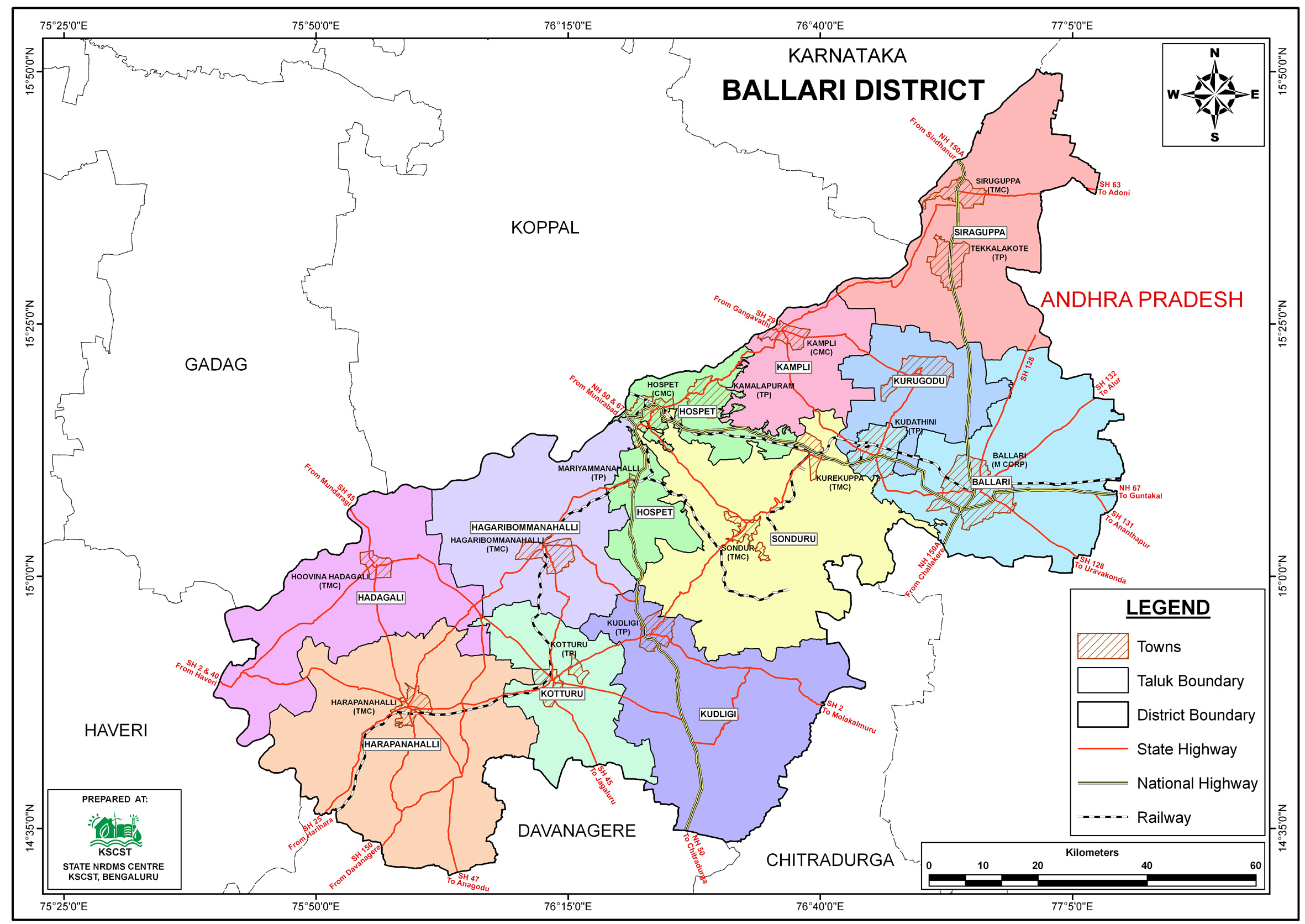
Ballari
district NRDMS
Centre was established in the year 2001-2002
at Office of the Ballari Zilla
Panchayath with financial support from Department of Science and
Technology, Government
of India, Implemented by K.S.C.S.T, Bangalore with active
support from Department
of Science &
Technology, Government
of Karnataka. The main objective of the centre is to create
the digital database on Natural resources, Demography, Agro &
Socio economy and infrastructure facilities of the
District to provide analysed information to the district
administrators, Zilla panchayath, line departments, Academic
institutions and NGOs in Natural resources management and
rural development planning with the help of GIS and
other advanced scientific technologies.
Activities carried
out at District NRDMS Centre
-
The primary
objective of District NRDMS Centre under NRDMS Project is to
create Extensive database on Spatial Database (Maps) and Non-Spatial
Database (Attribute data) of Natural Resources, Socio & agro-eeconomic
parameters and Infrastructure facilities of the district
after collating from the line departments and other
organizations and it is been updating regularly based on
nature of availability of data and requirements.
-
Mapped the Village
wise flood affected map of Ballari District.
-
Preparation of Geo-Spatial Action Plan Maps (2025-26):
Geo-Spatial Action Plan Maps were initiated for the Woman &
Child Development Department and the Animal Husbandry and
Veterinary Services (AHVS) Department for the 2025-26
planning cycle in Ballari District.
-
Health Department Geo-Spatial Planning: Completed or
continued the development of the Geo-Spatial Action Plan Map
for the Health Department specifically for the 2024-25
period in Ballari District, providing a foundational spatial
dataset for health-related planning.
-
Geo-Spatial Mapping for GESCOM Section Supervision (Ballari
Taluk): A Geo-Spatial map was prepared using ArcGIS to
fulfill a request from the GESCOM Executive Engineer,
Ballari Taluk, for improved section-wise supervision.
-
District Police Support: Developed and delivered essential
geo-spatial tools, including Taluk-wise Police Jurisdiction
Maps and Accident Zone Heat Maps, to the District
Superintendent of Police, Ballari, to enhance administrative
efficiency and identify high-risk areas.
-
Fire Station Location and Coverage Mapping (Ballari
District): Developed a Ballari District Fire Station
Location Map for the District Fire Station Department using
GIS tools (Buffer Analysis, Spatial Join) to clearly
identify and map all villages covered under each Fire
Station's taluk jurisdiction.
-
Preparation and provision of specialized maps (Road Network,
Taluk Boundary, and Road Sector Maps) to the PWD and PRED
Executive Engineer to facilitate infrastructure planning,
resource allocation, and project implementation for the
proposed rural roads under the KMERC initiative in Sandur
and Ballari taluks for the year 2025-26.
Activity Report for the
Month April - July 2025
Activity Report for the
Month August - November 2025
Activity Report for the
Month December 2025 - March 2026
* ~ * ~ *
|


