|
District NRDMS Center,
Bengaluru South
O/o Zilla Panchayath, Bengaluru
South,
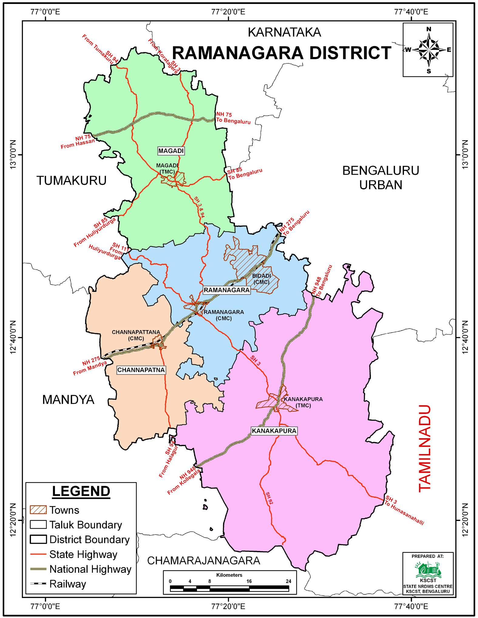
Bengaluru South (Ramanagara) District -
571511
Introduction
The
Bengaluru South
district NRDMS Centre was established in the year
2008-2009
at Office of the
Bengaluru South
Zilla Panchayath
with financial support from Department of Science and
Technology, Government
of India, Implemented by K.S.C.S.T, Bangalore with active
support from Department
of Science &
Technology, Government
of Karnataka. The main objective of the centre is to create
the digital database on Natural resources, Demography, Agro &
Socio economy and infrastructure facilities of the
District to provide analysed information to the district
administrators, Zilla panchayath, line departments, Academic
institutions and NGOs in Natural resources management and
rural development planning with the help of GIS and
other advanced scientific technologies.
Activities carried
out at District NRDMS Centre
-
The primary
objective of District NRDMS Centre under NRDMS Project is to
create Extensive database on Spatial Database (Maps) and Non-Spatial
Database (Attribute data) of Natural Resources, Socio & agro-economic
parameters and Infrastructure facilities of the district
after collating from the line departments and other
organizations and it is been updating regularly based on
nature of availability of data and requirements.
Homestay Maps for Resorts (New Permission), Bengaluru South:
Prepared GIS maps of existing and proposed homestays using
drainage lines, LULC, village boundaries, habitations, and
GPS locations; extracted data using micro-village boundaries
and clip tools, and submitted to the Assistant Director,
Tourism Department, Bengaluru South.
Proposed Kanakapura Sub-Division Police Station Map:
Prepared GIS maps using village and Taluk boundaries, major
district roads, and national highways to support the
proposal submitted to the State Government.
Kanva Reservoir and Watershed Mapping: Prepared GIS-based
maps identifying Kanva River inlets and proposed
rejuvenation areas using GP boundaries, drainage and
waterbody layers, watershed and cadastral data, and
georeferenced toposheets; applied geoprocessing and clip
tools to generate the proposal.
Baginigere Kaval Horticulture Development Map: Prepared
GIS-based development and plantation maps for Baginigere
Kaval using LULC, drainage, contour, and waterbody layers;
digitized plantation polygons acre-wise and applied
symbology for visualization.
SWM Route Map for Waste Collection: Prepared GIS-based
routes for waste collection vehicles across all Gram
Panchayats using district and Taluk boundaries, road
networks, GP locations, and CMC/TMC boundaries, with
distances calculated in kilometers.
Activity Report for the
Month April - July 2025
Activity Report for the Month August - November 2025
Activity Report for the Month December 2025 - March 2026
* ~ * ~ *
|


