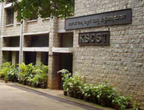
|
District NRDMS Center,
Bengaluru Rural
O/o Zilla Panchayath, Devanahalli Taluk,
Bengaluru Rural District - 562110
Introduction
The
Bengaluru Rural
district NRDMS Centre was established in the year
1996-1997
at Office of the
Bengaluru Rural
Zilla
Panchayath with financial support from Department of Science and
Technology, Government
of India, Implemented by K.S.C.S.T, Bangalore with active
support from Department
of Science &
Technology, Governmentt
of Karnataka. The main objective of the centre is to create
the digital database on Natural resources, Demography, Agro &
Socio economy and infrastructure facilities of the
District to provide analysed information to the district
administrators, Zilla panchayath, line departments, Academic
institutions and NGOs in Natural resources management and
rural development planning with the help of GIS and
other advanced scientific technologies.

Activities carried
out at District NRDMS
-
The primary
objective of District NRDMS Centre under NRDMS Project is to
create Extensive database on Spatial Database (Maps) and Non-Spatial
Database (Attribute data) of Natural Resources, Socio & agro-eeconomic
parameters and Infrastructure facilities of the district
after collating from the line departments and other
organizations and it is been updating regularly based on
nature of availability of data and requirements.
-
Water
Conservation Planning: Developed District Scientific Water
Conservation Plans using GIS and Remote Sensing maps.
-
Check Dam Mapping: Identified and mapped 40 Proposed Check
Dams in Devanahalli Taluk (Bengaluru Rural District) with
precise GPS coordinates.
-
Resource Mapping: Provided maps and information on Water
Resource maps, Check Dam maps, Watershed boundaries, and
Traditional Water Harvesting Structures to the Zilla
Panchayath CEO.
-
Prepared and submitted 5km buffer maps of Mining Affected
Villages to the CEO and Mines & Geologist Office, Bengaluru
Rural.
-
Identified and listed 130 villages across Hosakote,
Nelamangala, Doddaballapura, and Devanahalli taluks affected
by mining activities for planning and rehabilitation.
-
Prepared a map showing the location of existing and proposed
PHC/UPHC centers based on population data
Bengaluru
Rural Data
Dictionary
ZP
Constituencies
of Bengaluru Rural
Bengaluru Rural -
Water
Report July
2011
Activity Report for the
Month April - July 2025
Activity Report for the
Month August - November 2025
* ~ * ~ *
|


